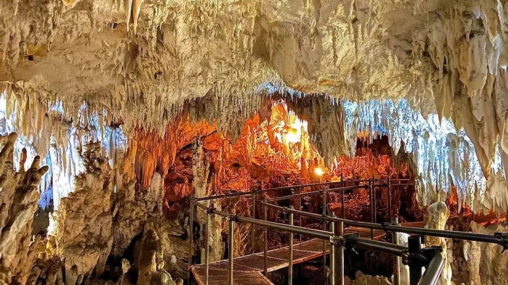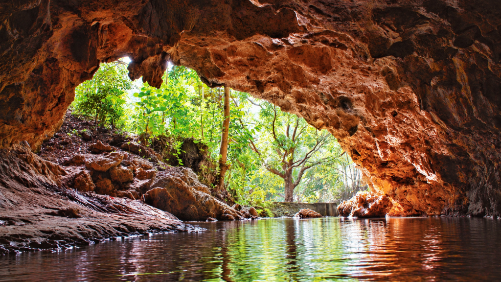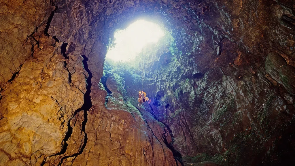
Odloman Cave is a landscape of connected spaces beneath Mabinay. Large galleries give way to narrower corridors, while streams run through parts of the system. Its attraction lies in the extent and complexity of an underground world that takes skill and effort to explore.
Published survey accounts record 8,870 metres of passages. That figure describes the combined length of a cave system, rather than a single chamber or a straightforward route through it. For readers drawn to serious caving, Odloman introduces a more demanding dimension of Negros Oriental’s interior.
A System Beneath the Hills
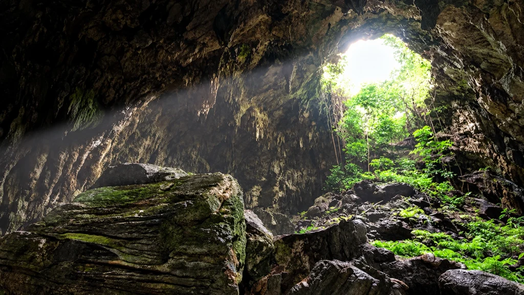
The National Commission for Culture and the Arts describes five connected entrances and a mixture of large and small galleries, including passages carrying active streams. Odloman’s scale therefore comes from the relationships between its spaces as much as the size of any individual room.
An underground system has a different geography from the landscape overhead. Passages connect places that cannot be understood simply by looking across the hills. A survey begins to reveal those connections, turning separate entrances and chambers into a comprehensible network.
That is part of Odloman’s appeal even for someone who has no intention of entering it. The known extent of its passages adds another dimension to Mabinay’s landscape: beneath the visible terrain lies a substantial mapped environment.
The Demands of Exploration
Descriptions of entering Odloman include rappelling through an opening above or swimming across an underground river. Published coverage places it among Mabinay’s caves for experienced explorers, reflecting the physical demands of its entrances and passages.
Those accounts establish its character without making it a casual sightseeing proposition. Large galleries, confined corridors and moving water create different challenges within the same system. Appreciating the cave involves more than reaching an impressive interior.
For the serious caver, that variety is central to its interest. For other readers, documented exploration and cave photography offer ways to understand its scale and terrain. Odloman contributes a specialist pursuit to the region’s broader range of experiences.
Mapping an Underground Landscape
Odloman also has a documented exploration history. Photographer René Prévot recalls taking part in caving expeditions to Negros in 1989 and 1992. His account identifies Odloman among the caves mapped during the wider programme and records the same 8,870 metre passage length.
The value of that history is more than a measurement. Surveying establishes how passages relate to one another, creating a record of a landscape that cannot be viewed in its entirety from one position.
Prévot’s account places Odloman within an international exploration effort focused on Negros Oriental. It provides a human perspective grounded in investigation and documentation, alongside the cave’s natural features.
Water Within the Stone
Active streams distinguish parts of Odloman from a purely dry underground chamber. Water belongs to the system’s recorded character, alongside its galleries and narrow connections.
Together, these features make Odloman a strong contrast within Mabinay’s cave landscape. Its story centres on extent, movement and exploration, revealing a place whose interest develops through the connections between its passages.