Mount Kanlaon introduces a different scale to the landscapes of Negros Oriental. The active volcano rises on the boundary with Negros Occidental, while Canlaon City (same name, different spelling) occupies its eastern side. The two names distinguish the mountain from the community beneath it: Kanlaon is the volcano, and Canlaon is the city.
Together, they offer more than a view of a summit. Terraced fields, vegetable growing areas and a highland settlement create a landscape in which the mountain is both a visual presence and part of everyday surroundings. For visitors exploring the province, the attraction lies in that relationship between a major natural landmark and the countryside around it.
A Mountain That Defines the View
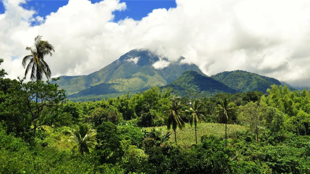
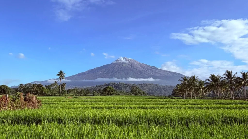
Kanlaon is the highest mountain on Negros and in the Visayas. Its mass gives the surrounding landscape a strong focal point, particularly when visibility allows the higher slopes to emerge above the countryside.
The experience from Canlaon is one of looking towards the volcano across a lived landscape. Fields and buildings provide scale in the foreground, while the mountain draws attention beyond them. That combination can be more revealing than a photograph of the summit alone.
Cloud and visibility influence how much of the mountain can be seen. A clear outline is one possible encounter; a partly concealed summit offers another. Any visit also depends on volcanic conditions and official restrictions, which take precedence over the desire for a particular view.
Terraces and the Working Countryside
Canlaon’s agricultural character is central to its appeal. Rice and vegetable terraces are promoted as features of the city’s landscape, with cultivated slopes adding patterns and textures to the mountain setting.
The city’s published agricultural profile includes crops such as potatoes, carrots, cauliflower, broccoli, ginger and spring onions, alongside rice and cut flowers. These are part of a working economy as well as scenery that interests visitors.
The terraces invite closer observation of how farming occupies sloping ground. Looking across them, the eye follows field boundaries and changes in level before returning to the mountain beyond. For photography, they offer a foreground with meaning: the land is being used, tended and harvested.
Different stages of cultivation can change the appearance of the fields. Their interest therefore extends beyond a single panoramic image to the relationship between crops, terrain and the people who work there.
Seeing the Landscape at Farm Scale
The OISCA Model Farm provides a more specific agricultural perspective within Canlaon’s published visitor offering. Its local tourism description includes terraced rice plantations, vermiculture, water impoundments used for fishery and planted forest.
It illustrates how a highland visit can combine landscape appreciation with curiosity about cultivation and land management. The attraction is the arrangement of several activities within rolling terrain, rather than the volcano alone.
The farm’s published description also identifies an elevated outlook across the area. Current visitor access must be established before including it in an itinerary, but it offers a useful example of the broader interests that Canlaon can support when conditions permit.
A City Beneath an Active Volcano
The setting of the Canlaon beneath Kanlaon carries practical consequences as well as visual appeal. Kanlaon is active, and volcanic unrest can affect roads, communities, farms and visitor destinations.
The mountain and its surroundings should therefore be approached with current local information. A distant view, a city visit and an excursion to a farm are different activities, each requiring confirmation that the route and destination are accessible.
Another Dimension of Life in Negros Oriental
Canlaon adds a cultivated highland experience to the province’s range of landscapes. The appeal may begin with the volcano, then develop through interest in terraced ground, agricultural produce and the character of a mountain community.
For someone considering a longer stay in Negros Oriental, this combination introduces another reason to explore the island’s interior. It offers a setting where landscape and livelihood are visible together, with several perspectives to discover beyond the initial photograph.
The most worthwhile encounter is one that gives attention to both names: Kanlaon for the mountain that shapes the horizon, and Canlaon for the community and countryside that give the foreground its character.